Port Gawler land release
The scandal of 1839
A never-before-seen manuscript map with a scandalous history.
On display in the Mortlock Chamber at the State Library of South Australia.

The State Library of South Australia has received a rare hand-coloured, gilded map, which has an extraordinary tale to tell.
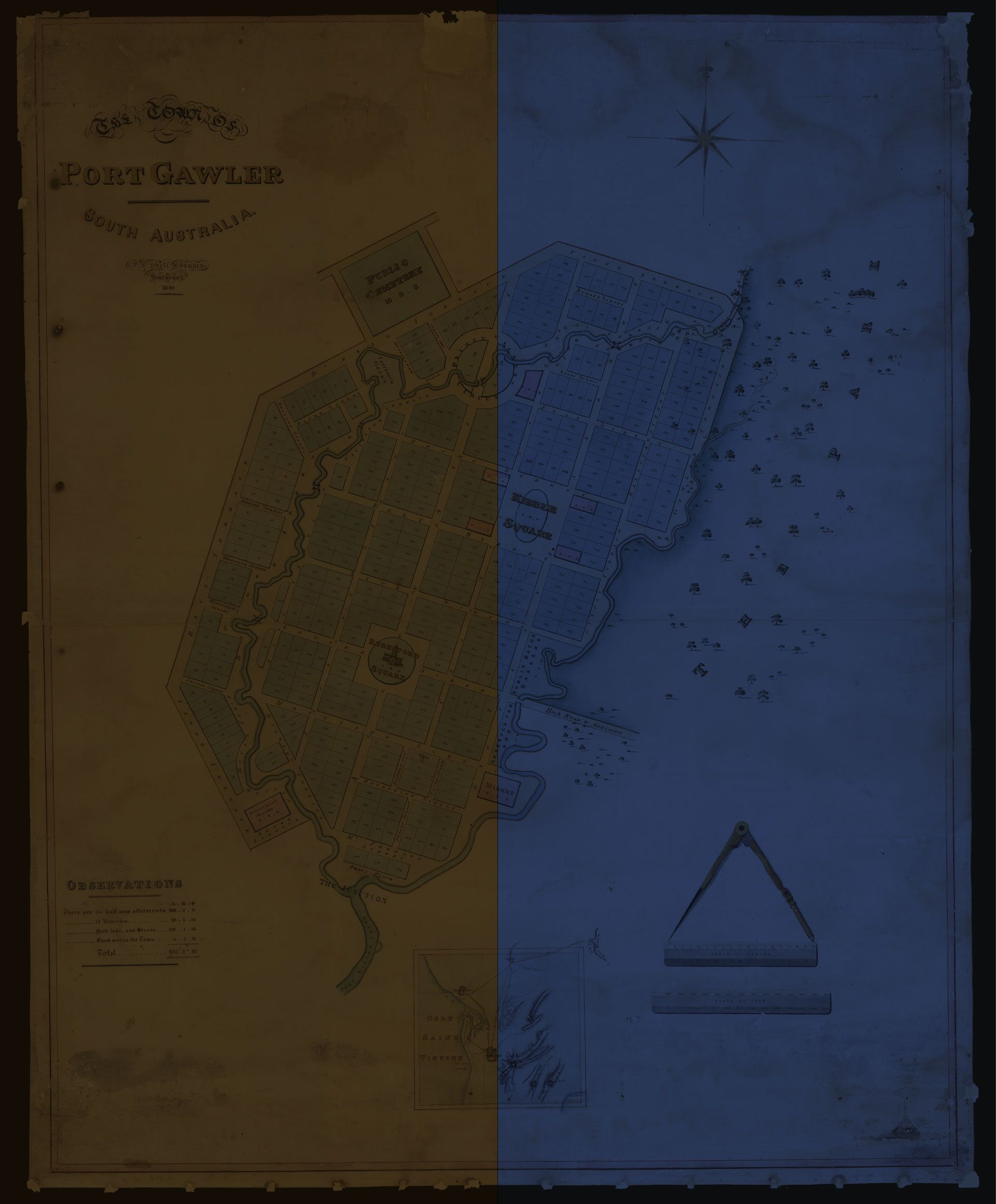
Generously presented by the Friends of the State Library of South Australia, The Town of Port Gawler map was created under commission by surveyor Philip L.S. Chauncy and finished in 1840. The map shows neat parcels of land, a town square, a market, and a cemetery laid out between two creeks of the Port Gawler River. But the town of Port Gawler was never built.
Dig deeper into the story of this proposed town, and you will find a scandalous story of brotherly betrayal, colonial price gouging, and legal intrigue which gripped the early Adelaide community, over land and waters traditionally owned by the Kaurna people of the Adelaide Plains.
An experimental plan
Edward Gibbon Wakefield’s experimental plan for colonisation in South Australia was based on raising money by selling supposedly unoccupied land to 'respectable middle class English persons' at a low cost.
What Wakefield did not foresee was that eager land speculators would cause land values to increase very quickly – and make the establishment of farming more difficult.
The colony’s first governor, Sir John Hindmarsh, was a prolific land purchaser and speculator. When he was recalled to London in 1838 Lady Hindmarsh remained in Adelaide to sell what land she could before returning to England with her children. George Milner Stephen, the colony’s young Advocate General, a regular visitor at Government House, assisted Lady Hindmarsh with her business arrangements. In return, she lent him money to make his own land investment by purchasing 4,000 acres (1,600 hectares) of swampland 43 kilometres north of Adelaide which he dubbed ‘Port Gawler’ after the new governor, Sir George Gawler. It soon became known as The Milner Estate.

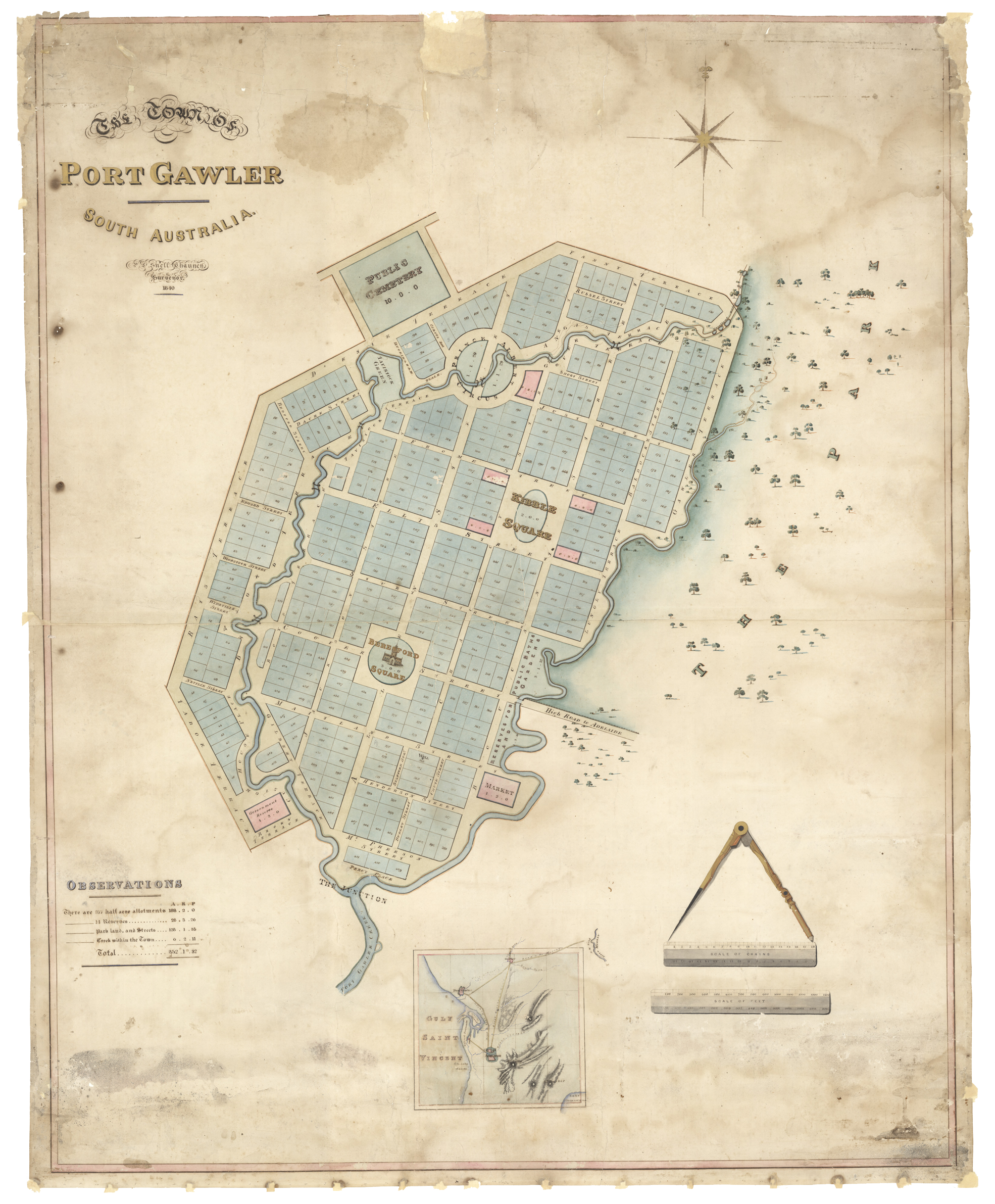
The plan of ‘The Town of Port Gawler’ was created by cartographer Philip L S Chauncy (1816 – 1880). SLSA C 1191. The plan depicts the intended layout of the town between the two branches of Port Gawler Creek, including a largely grid-pattern design, with streets named after mariners, explorers, colonists, and English royalty.
The plan of ‘The Town of Port Gawler’ was created by cartographer Philip L S Chauncy (1816 – 1880). SLSA C 1191. The plan depicts the intended layout of the town between the two branches of Port Gawler Creek, including a largely grid-pattern design, with streets named after mariners, explorers, colonists, and English royalty.
The intercepted letter
George Milner Stephen was a talented young man. Whilst working as a legal clerk in Van Diemen’s Land (Tasmania) in 1837, he intercepted a letter for his brother Alfred, Tasmania’s Crown Solicitor. Addressed simply to ‘Mr Stephen’, the letter from Governor John Hindmarsh invited Alfred Stephen to become Advocate General (legal advisor) to South Australia’s colonial government.
George was the one who arrived in Adelaide a few months later and was made both Advocate General and Crown Solicitor. Despite his lack of legal training, he studied hard and became a popular figure in the small community. He visited the Hindmarsh family daily.
Stephen openly boasted about the value of his Port Gawler land. Having quickly re-sold half the land to his newly arrived associates, pastoralist Captain William Allen of the East India Company, and Captain John Ellis also of India, he employed John Hindmarsh junior and his partner Arthur Lindsay to survey the remaining portion for residential blocks.

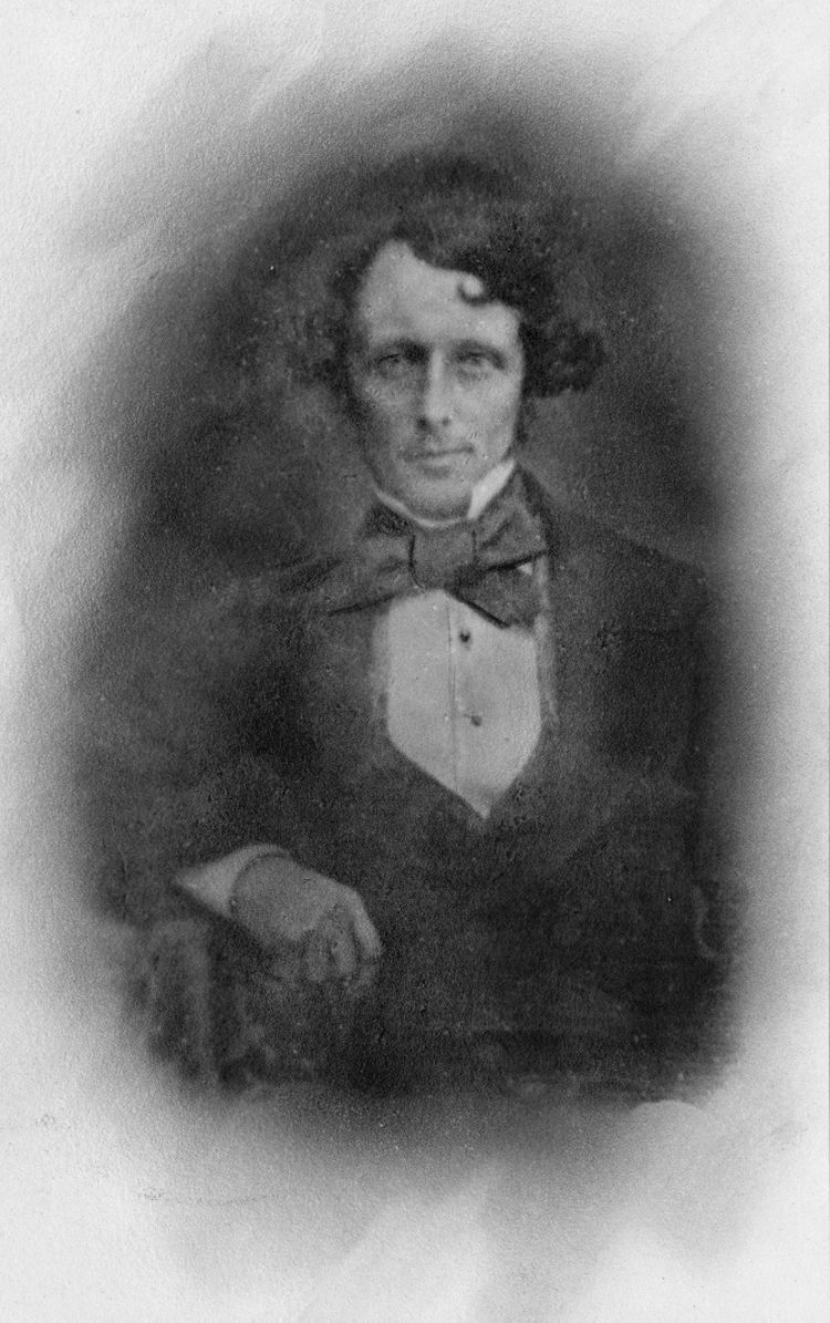
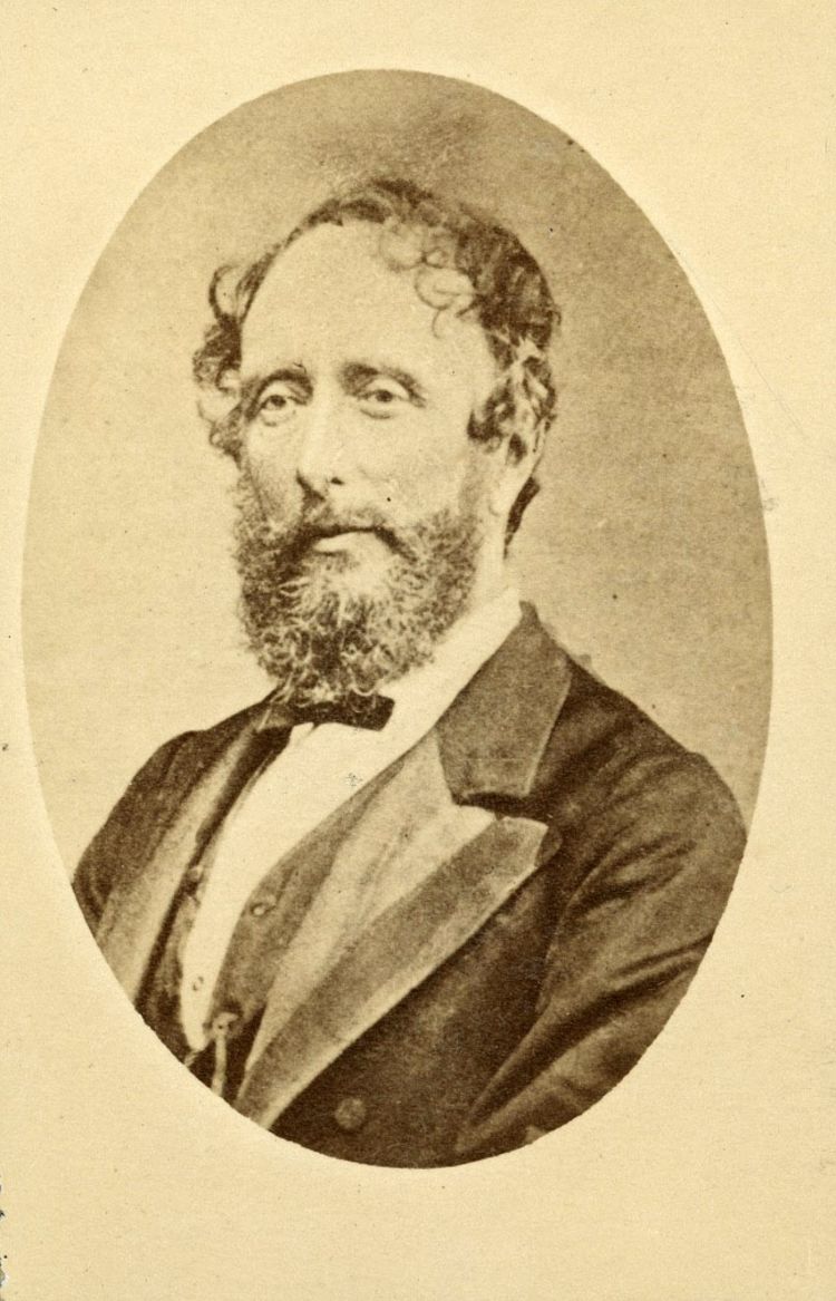
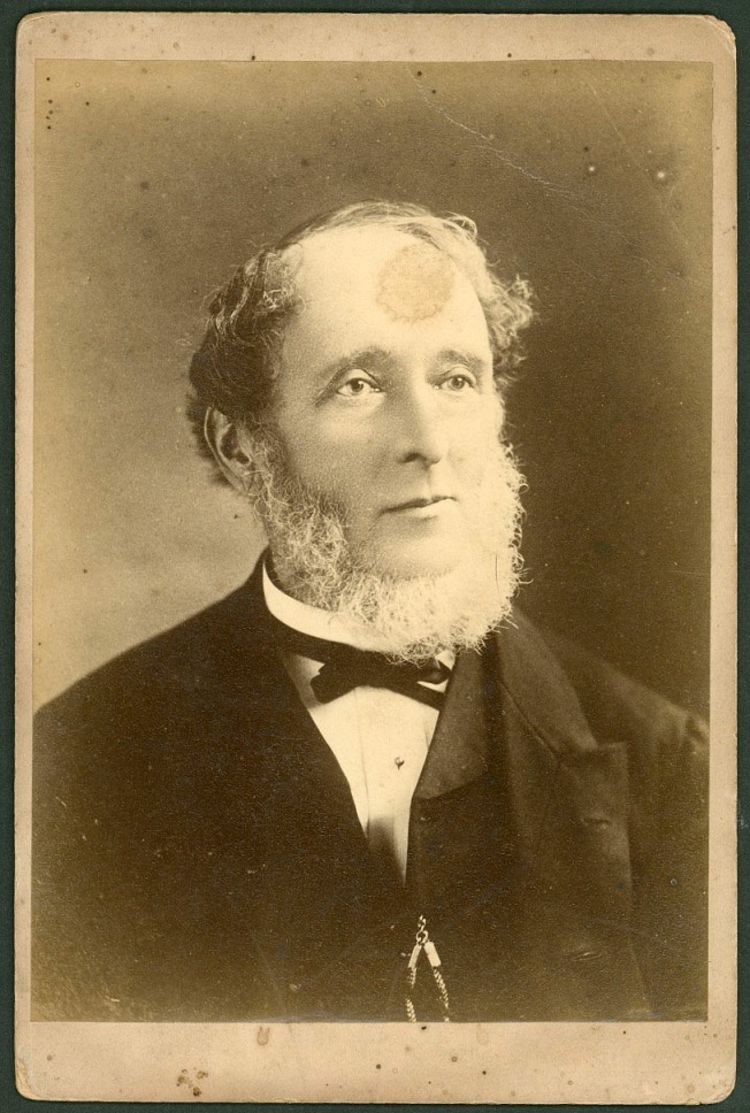
George Milner Stephen was known as a charismatic fellow, and here he wears a fashionable hair style and large bow tie. He acted as Governor of South Australia for a brief period between the departure of Governor Hindmarsh and the arrival of Governor Gawler (July - October 1838). Copied from a daguerreotype image, 1841, London. SLSA: B 7011
George Milner Stephen was known as a charismatic fellow, and here he wears a fashionable hair style and large bow tie. He acted as Governor of South Australia for a brief period between the departure of Governor Hindmarsh and the arrival of Governor Gawler (July - October 1838). Copied from a daguerreotype image, 1841, London. SLSA: B 7011
Commissioning the map
Captains Allen and Ellis commissioned surveyor Philip Chauncy to create The Town of Port Gawler map, intending to build homes, and start a saw-mill and agricultural operations on the land.
The map would most certainly have been commissioned to create a sales brochure, to promote the land for sale at a profit. There is no record that the map was ever published and it is believed the map now held by the State Library of South Australia is the only copy.
Amateur ethnographer and surveyor Philip Lamothe Snell Chauncy (1816 – 1880) designed the layout of the town and included all the facilities expected of an English-style settlement.
The plan depicts the intended layout of the town between the two branches of Port Gawler Creek, including a largely grid-pattern design, with streets named after mariners, explorers, colonists, and English royalty. There are two squares, a circus, plus land designated for public baths, gardens, a market, and the ubiquitous cemetery on the edge of the town.


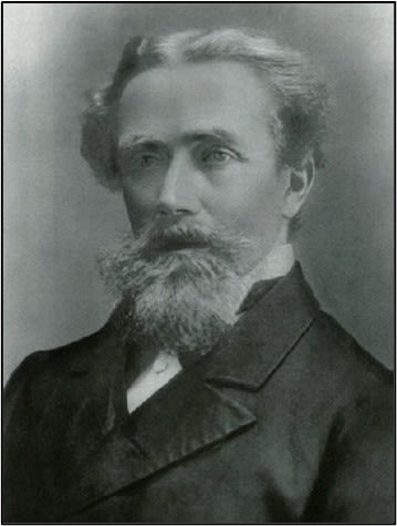
Captain John Ellis (1803 – 1873), a pioneer pastoralist, was one of the men who commissioned the Town of Port Gawler map. He made a considerable fortune from land speculation. SLSA: B 10828
Captain John Ellis (1803 – 1873), a pioneer pastoralist, was one of the men who commissioned the Town of Port Gawler map. He made a considerable fortune from land speculation. SLSA: B 10828

Mapmaker Philip Chauncy arrived in Glenelg, South Australia in October 1839 and commenced in his profession of surveyor. THE LATE MR. PHILIP CHAUNCY. (1880, June 7). The Church of England Messenger and Ecclesiastical Gazette for the Diocese of Melbourne and Ballarat, Vic., p. 6. This image from Anne's Family History, taken from Ancestry.com
Mapmaker Philip Chauncy arrived in Glenelg, South Australia in October 1839 and commenced in his profession of surveyor. THE LATE MR. PHILIP CHAUNCY. (1880, June 7). The Church of England Messenger and Ecclesiastical Gazette for the Diocese of Melbourne and Ballarat, Vic., p. 6. This image from Anne's Family History, taken from Ancestry.com
This large hand-coloured manuscript plan of The Town of Port Gawler, South Australia' was created by surveyor P.L. Snell Chauncy, in 1840. The plan depicts the intended layout of the town between two branches of Port Gawler Creek.
The typography of the 1840s is shown here reading 'The Town of Port Gawler South Australia. P.L. Snell Chauncy. Surveyor. 1840'.
A beautifully drawn, but ever so slightly faded compass, letting us know which way is north.
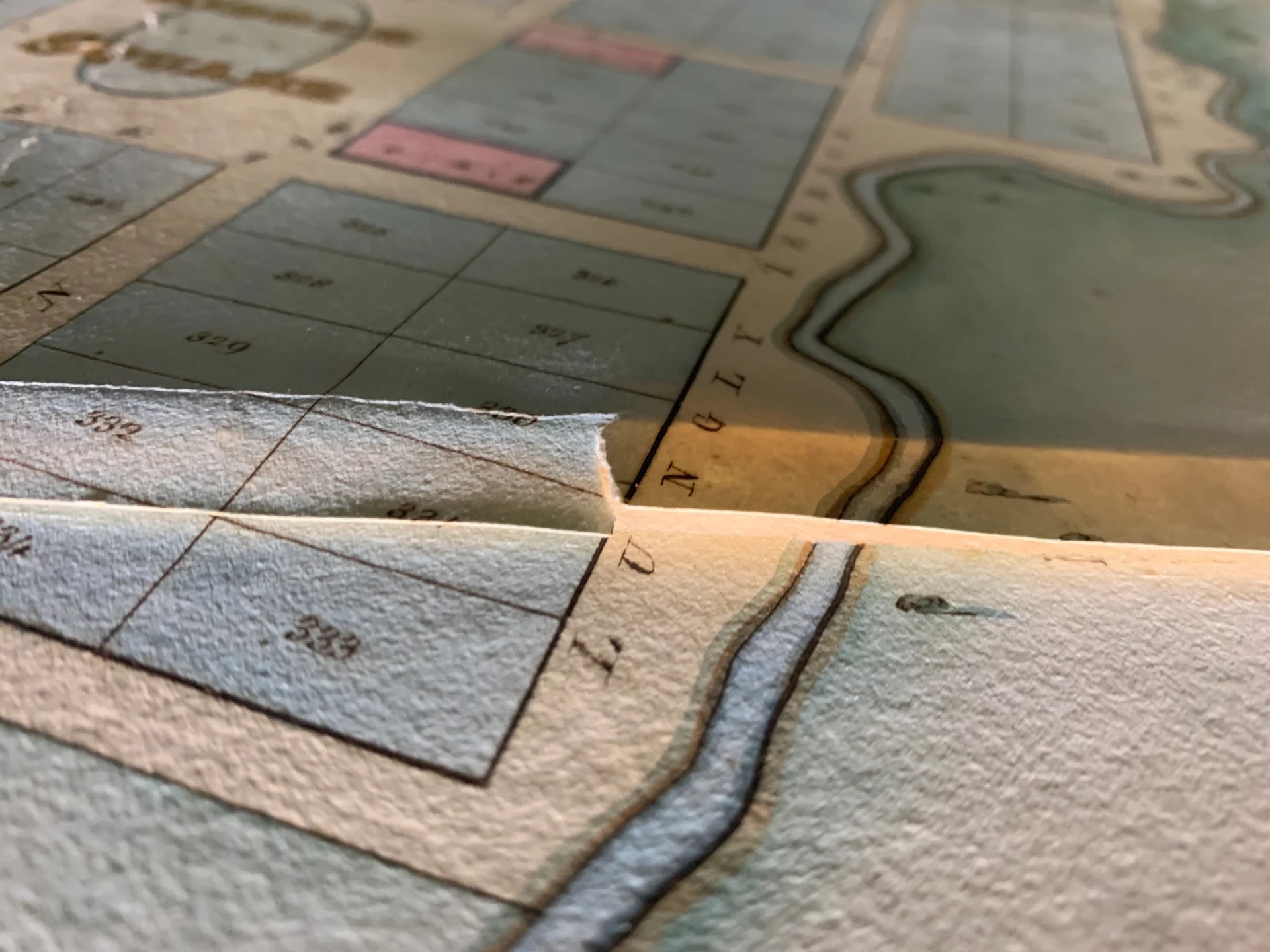
The northside of the town depicts a public cemetery, an area called 'Laverstock Green', and the 'Prince Albert Circus', with Gawler Creek running through it. Over the river, in places, there are little brackets depicting footbridges.
'Kibble Square' seems to be the business area of the planned town. The four pink areas are likely to denote public buildings. In one of the pink areas, you will notice slight wear-and-tear on the map.
To the right of the map is a vast area depicting trees and scrubs, aptly called 'The Park'.
The southern part of the proposed town has 'Beresford Square' featuring a church, and likely to be considered the town's centre. To the left is a 'Government reserve', and to the right, an area for a 'market'. Also depicted is a main road called 'High Road to Adelaide'.
The map features 'Observations':
|
A |
R |
P * |
|
|
There are 377 half acre allotments |
188 |
2 |
0 |
|
14 Reserves |
28 |
3 |
26 |
|
Park land, and Streets |
128 |
1 |
35 |
|
Creek within the Town |
6 |
2 |
11 |
|
Total |
352 |
1 |
32 |
* Acres, Roods, Perches
The surveyor included a small inset showing the location of Port Gawler within the Adelaide region. Its details include Gawler in the north, Gulf Saint Vincent and Glenelg Roads to the right, the City of Adelaide, and then the hills of Adelaide - Mount Lofty and Mount Barker. In the top right corner is the River Murray and in the corner below, Lake Alexandrina.
The detail and craftsmanship of the illustration and elements of the map is simply exquisite. This section features a compass and rulers denoting the map's scale.
Some staining is apparent around the edge of the plan, including either cigarette or cigar burns.
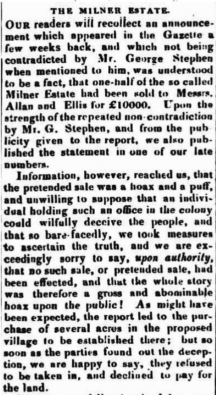
Hoax and puffery: The first court case
Stephen was said to have claimed the sold portion had made five times the total original price, £20,000.
The Southern Australian newspaper, picking up the rumour through the usual channels in a small community, turned it into a sensational news story, claiming the sale was a hoax and the amenity of the area was ‘puffery’.
Stephen took the newspaper to court, successfully charging the printer, Archibald McDougall (late of Hobart), with libel and stating under oath that the portion of land sold had raised only £10,000. The £20,000 figure, Stephen said, was the total potential value of the property, not the figure raised by the sale.

Part of an article about George Milner Stephen and his land value speculation, Southern Australian, May 8, 1839, page 3. Read the entire article on Trove. A flurry of articles were printed about this matter.
Part of an article about George Milner Stephen and his land value speculation, Southern Australian, May 8, 1839, page 3. Read the entire article on Trove. A flurry of articles were printed about this matter.
Wilful and corrupt perjury: The second court case & Counter claim
Printer McDougall retaliated with a charge of ‘wilful and corrupt perjury’ against George Stephen, based on the evidence of fellow newspaper man, George Stevenson of the Register. Stevenson had a letter written to him by Stephen stating the land sale had raised £20,000.
In court for the second case, Chief Justice Sir Charles Cooper would not accept the letter because it had not been produced in the first trial, so Stephen was acquitted. Stephen then sued the Register printer for libel, claiming the ‘2’ in the letter was a forgery over his original ‘1’. Stephen lost the case.
The scandal permanently tarnished Stephen’s reputation. First his fellow magistrates refused to sit on the bench with him so that he was forced to resign. For income, he needed to sell more of his land (presumably at a lower price) and to give drawing lessons to the daughters of the Hindmarsh family.
In 1840 he married Miss Mary Hindmarsh and the young couple travelled to Heligoland, a group of islands in the North Sea which were a British colony at the time, and where Sir John Hindmarsh was then Governor. George Stephen became Hindmarsh’s private secretary, but news of the land debacle prompted a public complaint against his suitability.

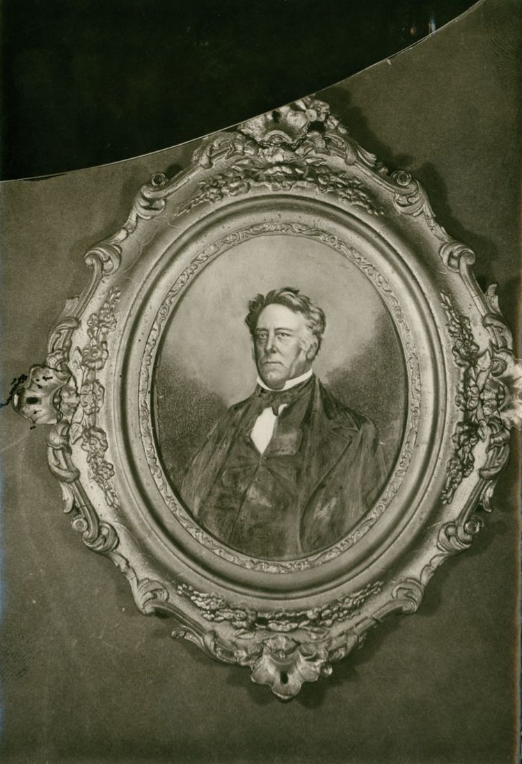
Just to confuse the issue, one of Stephen’s antagonists at the South Australian Gazette and Colonial Register newspaper was George Stevenson (1799-1856). Gilt-framed portrait, 1855. SLSA: B 3661
Just to confuse the issue, one of Stephen’s antagonists at the South Australian Gazette and Colonial Register newspaper was George Stevenson (1799-1856). Gilt-framed portrait, 1855. SLSA: B 3661

Sir Chief Justice Charles Cooper in 1880. SLSA: B440
Sir Chief Justice Charles Cooper in 1880. SLSA: B440
The fallout
Over the next years, George and his growing family were constantly on the move, followed by his reputation.
He returned to Adelaide as a lawyer for a short time, moved to Melbourne, back to Heligoland, and then to London where he trained as a lawyer, returned to Melbourne, and then moved to Sydney where he entered Parliament. The Port Gawler case was often brought up against him in the press or by individuals.
In the 1870s he found he had developed a gift for faith healing, achieving widespread fame and being widely sought-after. After helping a fellow traveller, he was quoted as saying,
In a few seconds…I recognised that I was one of the few people who were endowed with the healing power. I tried it again and again, with greater success than before, and I made up my mind to use my power to its fullest capacity.
His most famous patrons included Lady Parkes of Sydney and according to an obituary, even the Prince of Wales when Stephen was making a visit to London.
In 1840 the co-owners of the Register newspaper – George Stevenson and Robert Thomas – produced The Case of the Honourable Mr. George Stephen, a printed record of their version of the case, to perhaps capitalise on the public appetite for news about the trial. The only known copy, a publication proof, was passed down through the Thomas family until coming to the State Library in late 2022.
The Port Gawler land release saga did not end with the death of George Stephen in January 1894, but rippled down through the years, troubling his descendants and those of his adversaries.

George Milner Stephen, 1865, when he was aged 53. He began practicing as a faith healer in his late 50s, using his breath upon his client, to relieve internal pain. Alas he could not save himself from complications of a gall bladder affliction and died following surgery, in 1894. SLSA: B 5980
George Milner Stephen, 1865, when he was aged 53. He began practicing as a faith healer in his late 50s, using his breath upon his client, to relieve internal pain. Alas he could not save himself from complications of a gall bladder affliction and died following surgery, in 1894. SLSA: B 5980

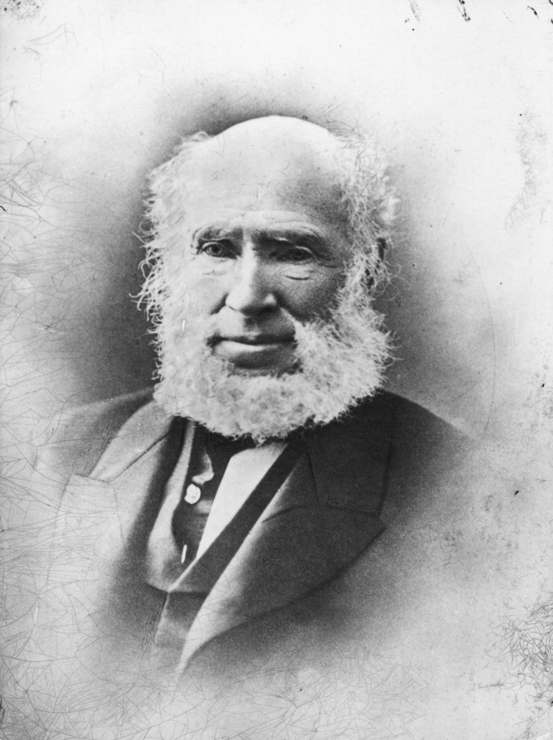
George Milner Stephen in about 1886. SLSA: B 24984
George Milner Stephen in about 1886. SLSA: B 24984


The gilded spine of The Case of the Honourable Mr George Milner Stephen, 1840. SLSA: RBR 994.2302 S823
The gilded spine of The Case of the Honourable Mr George Milner Stephen, 1840. SLSA: RBR 994.2302 S823
The art of preservation
Important cultural items like this map need to be carefully preserved so they can endure into the future.
Mould, insects, glue, light, framing and previous storage arrangements can all affect the condition of an important paper artefact and if left untreated, more decay can occur destroying the item and its history.
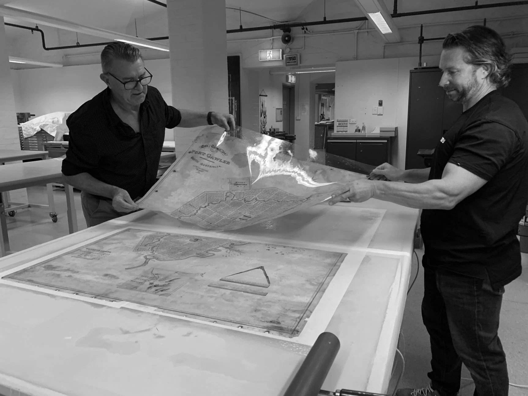
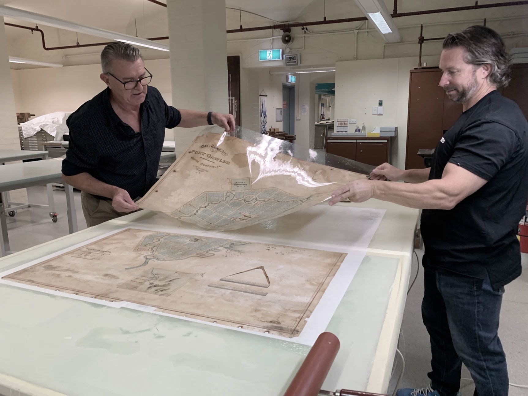
State Library of South Australia’s Senior Conservator, Peter Zajicek, has treated thousands of artefacts during his career. His experience prepared him well for the significant conservation work needed to preserve the fragile and ageing Port Gawler map.
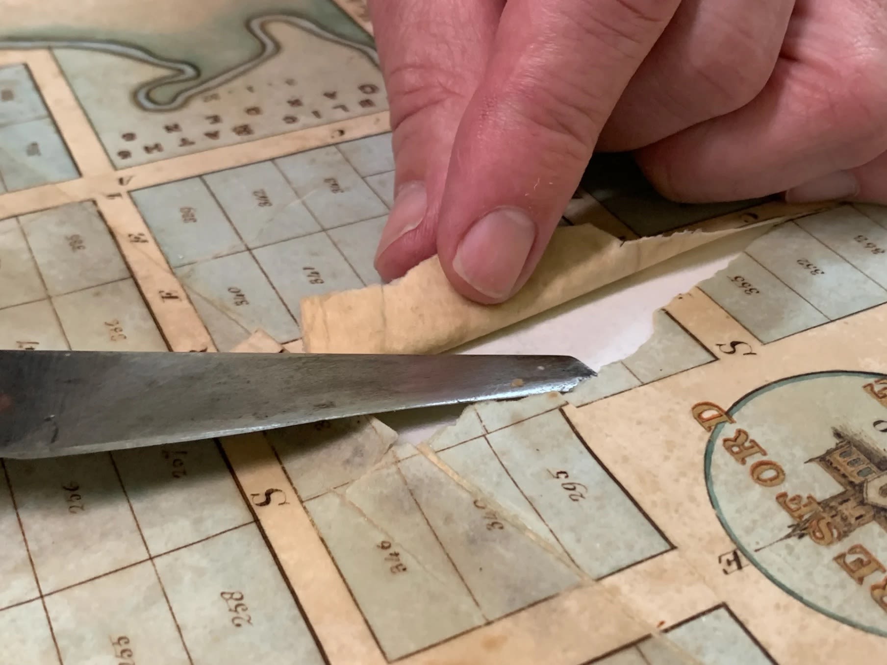
Once the map was removed from the heavy wooden frame, problems were revealed concerning previous mould treatment and many map fragments were lifting away from the support lining.

Peter working to lift the Port Gawler map from its backing, as part of the conservation treatment. SLSA: February 2023
Peter working to lift the Port Gawler map from its backing, as part of the conservation treatment. SLSA: February 2023
Thankfully the colours, and the gold lettering, were still vibrant but parts of the overall image were no longer aligned. Light testing over the surface of the map also revealed ‘cockling’ (rippling) across the entire map.
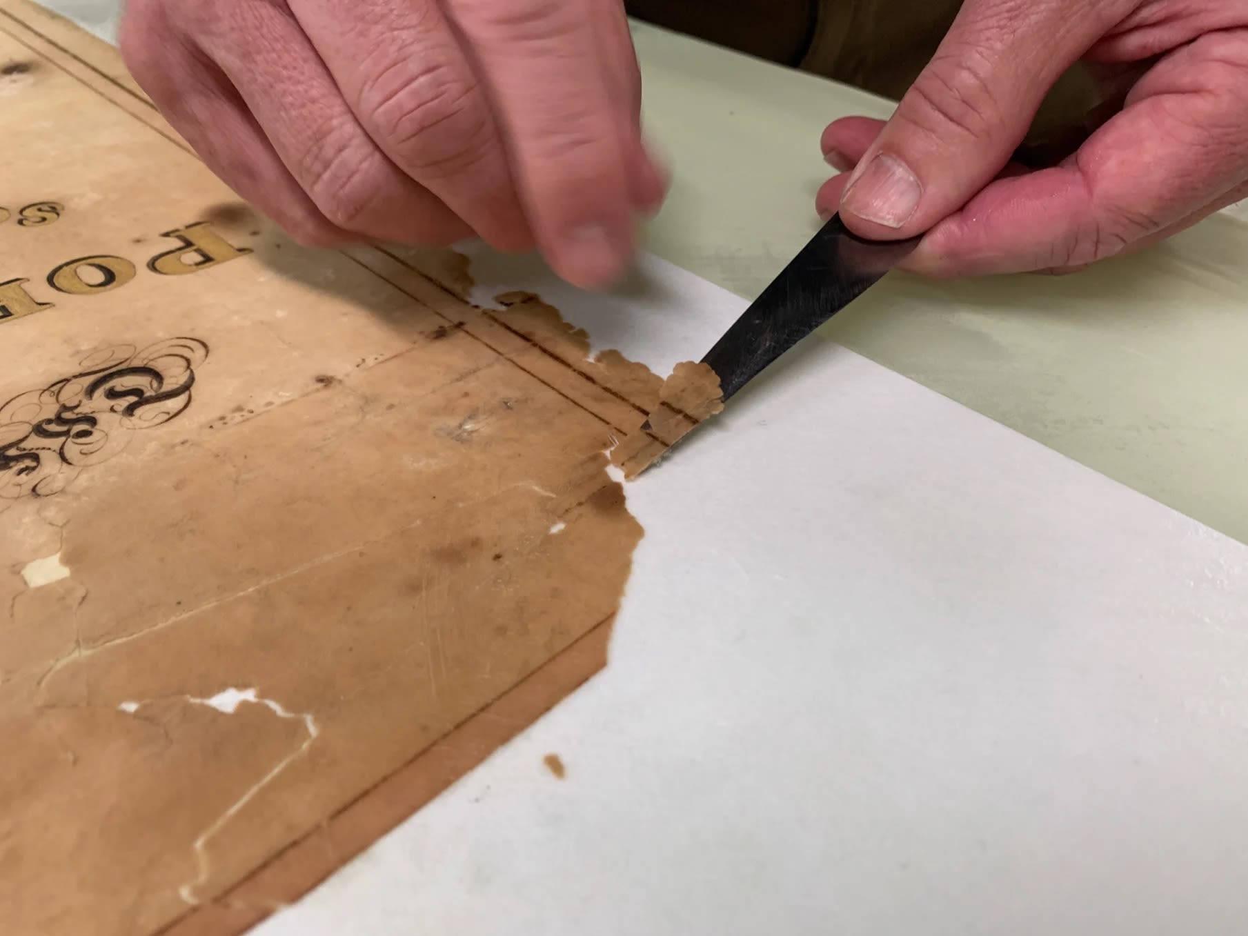
To fix this, the map was immersed into a special deionised water bath, which allowed the water-based glue of the support lining to loosen.
Once the map and lining started to separate, the map was removed from the deionised water and the backing was carefully removed. Then the map was attached to a new support lining which allowed parts of the image to be realigned.
The map needed to dry for two weeks before it was ready to be skilfully digitised by Senior Digitising Officer, Toby Woolley, after which it was put back into its original frame, ready for display.

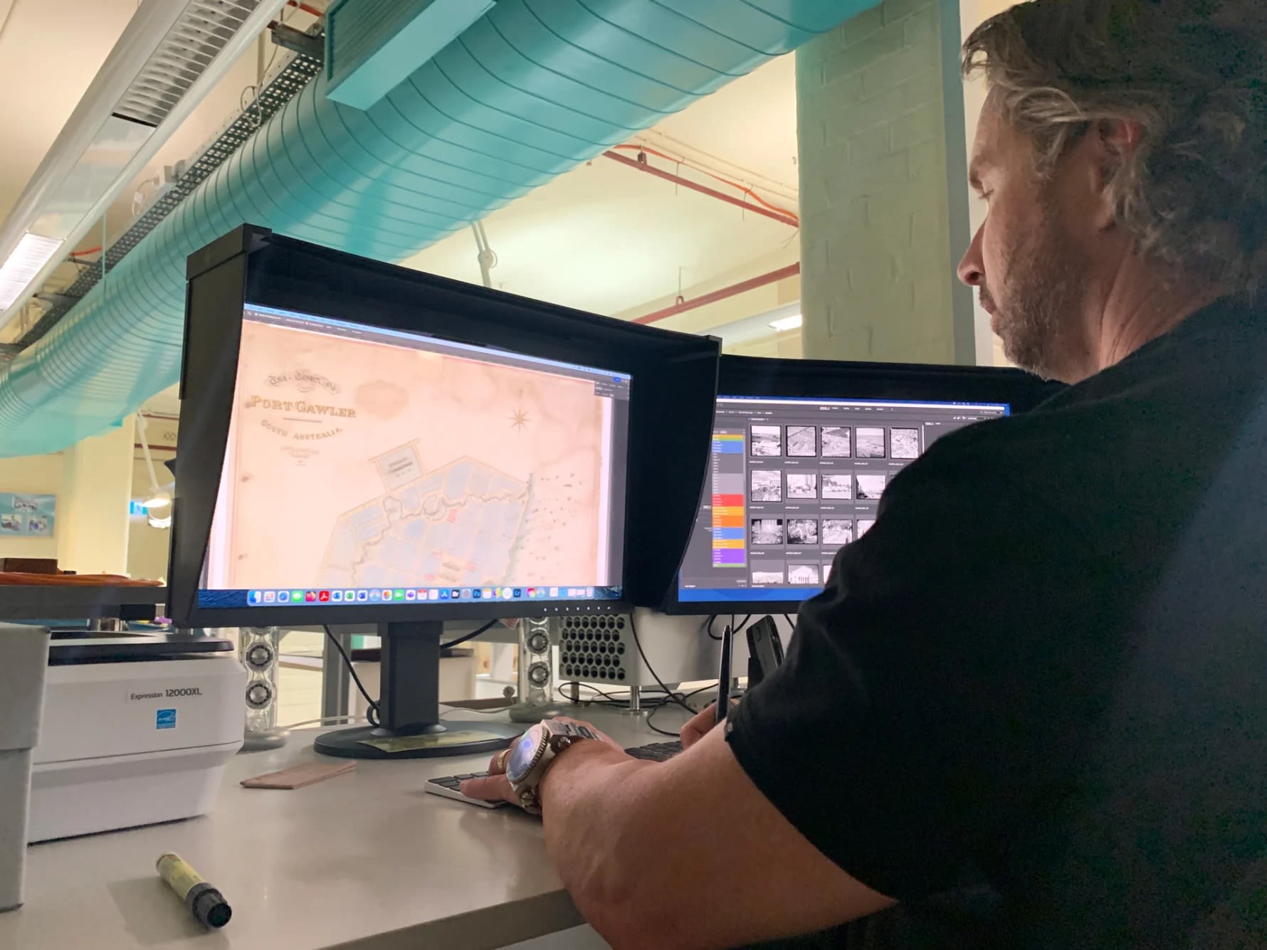
Toby Woolley mastering the digital file of the Port Gawler map. Photograph: SLSA, February 2023
Toby Woolley mastering the digital file of the Port Gawler map. Photograph: SLSA, February 2023
Having been refreshed, smoothed out and artfully preserved, the Town of Port Gawler map is now ready to continue its journey through history.


Peter working to lift the Port Gawler map from its backing, as part of the conservation treatment. SLSA: February 2023
Peter working to lift the Port Gawler map from its backing, as part of the conservation treatment. SLSA: February 2023

Peter carefully repositioning sections of the Port Gawler map. Photograph SLSA: February 2023
Peter carefully repositioning sections of the Port Gawler map. Photograph SLSA: February 2023
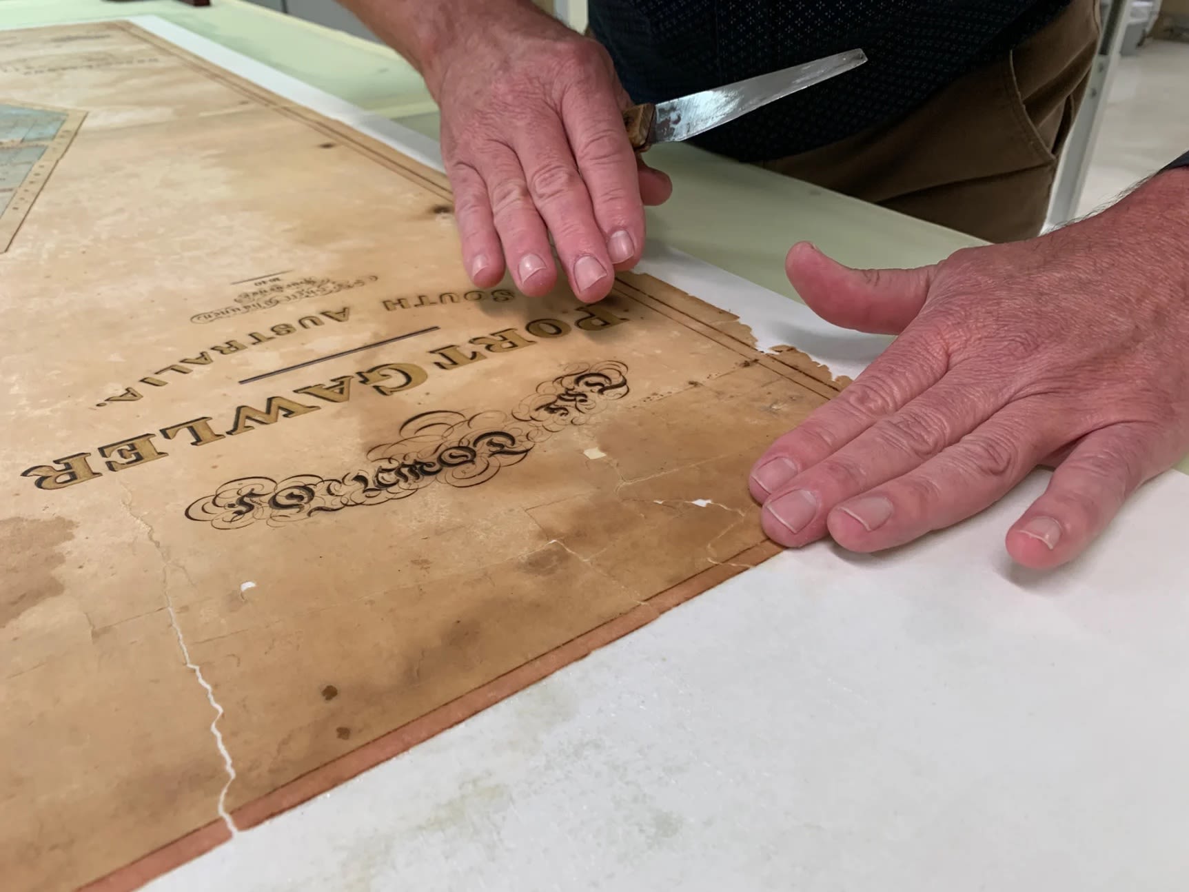
Peter aligning the pieces of the Port Gawler map. Photograph SLSA: February 2023
Peter aligning the pieces of the Port Gawler map. Photograph SLSA: February 2023

Peter Zajicek and Toby Woolley removing the map from the solution and attaching it to a new support lining which allowed parts of the image to be realigned. SLSA: February 2023
Peter Zajicek and Toby Woolley removing the map from the solution and attaching it to a new support lining which allowed parts of the image to be realigned. SLSA: February 2023

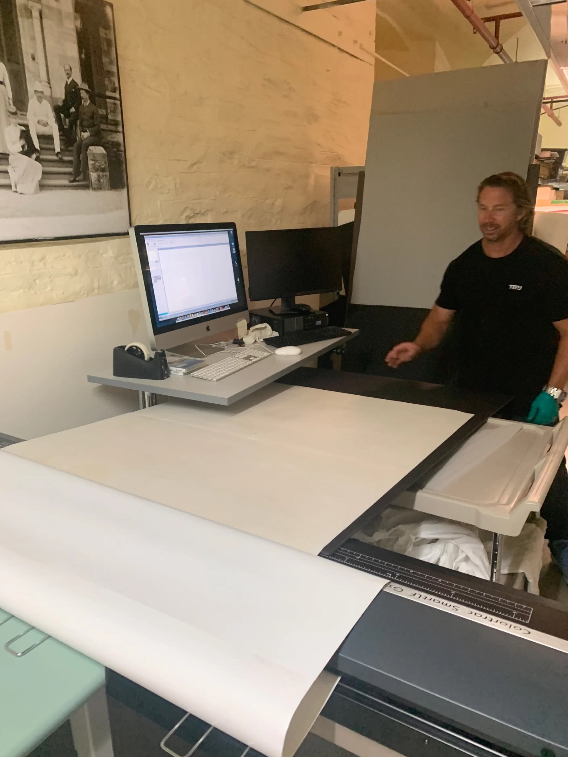
Toby Woolley positioning the equipment to digitise the Port Gawler map. Photograph: SLSA: February 2023
Toby Woolley positioning the equipment to digitise the Port Gawler map. Photograph: SLSA: February 2023

Toby Woolley mastering the digital files of the Port Gawler map. Photograph: SLSA: February 2023
Toby Woolley mastering the digital files of the Port Gawler map. Photograph: SLSA: February 2023
More to explore
Discovery of a splendid tract at the mouth of the Gawler River, South Australian Gazette and Colonial Register, 2 March 1839, Page 8 (G.M. Stephen's account of his journey to the Gawler river)
Milner Estate - Port Gawler, South Australian Register, Saturday 20 July 1839, Page 2
Papers of George Stephen, 1837 - 1858, 1938, SLSA: PRG 1045. Diaries, letter and papers relating to the libel action G.M. Stephen v. Macdougall
Stephen, Harold W. H., George Milner Stephen and his marvellous cures, by his son, Sydney, Turner and Henderson, 1880?
The State Library of South Australia acknowledges that the land and waters referred to as Port Gawler is unceded country of the Kaurna people, whose traditional lands also include the Adelaide Plains, where these events took place.

The Friends of the State Library of South Australia is the oldest library Friends group in Australia.
The hand-coloured manuscript map, The Town of Port Gawler (1840), is one of several significant gifts made by the Friends since their beginning in 1932.
With a tradition of cultural philanthropy, the Friends continue to support the State Library to collect and preserve items of significance to South Australians.
This gift was made possible by the Friends of the State Library’s Deane Miller Bequest.
If you enjoyed this story, make sure to share it via the social media buttons at the top of the page.
There are many stories to explore from the collections of the State Library of South Australia, visit the website to read and explore more. www.slsa.sa.gov.au
Contact Us | Media Centre | Copyright and the collection |
Search the Catalogue | Privacy Statement | Disclaimer